This was published 10 years ago
Port Macquarie, New South Wales: Travel guide and things to do
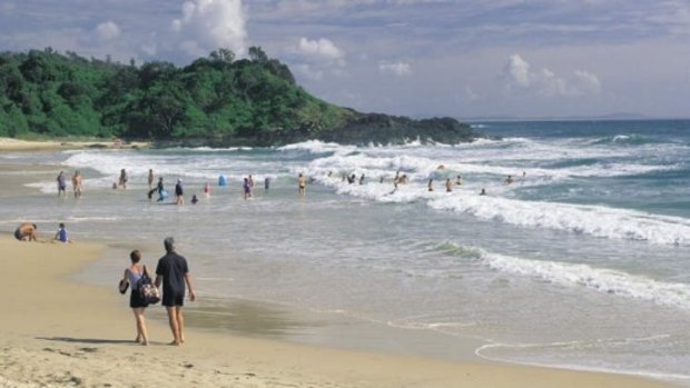
Flynns beach, Port Macquarie.
Port Macquarie must be one of the best tourist destinations on the NSW coast. It has everything: a history which dates back to convict times, superb nature reserves in the area, some interesting historical buildings, lovely beaches with good surfing and excellent fishing opportunities, a fine museum, beautiful walking tracks around the headlands and beaches, lots of amusements for the kids; even a koala hospital. And, of course, it has every kind of accommodation imaginable.
Port Macquarie is located 407 km north-east of Sydney and 17 metres above sea-level at the mouth of the Hastings River. With over 65 000 residents it is a rapidly expanding centre which serves as a regional capital to other resorts of the south such as Camden Haven. Tourism is obviously central to the local economy, although fishing, oyster farming, manufacturing and mineral processing are also important.
In historic terms, Port Macquarie is the most significant town between Newcastle and the Queensland border. Prior to European settlement, the area is thought to have been occupied by the Kattang Aborigines. Captain Cook sailed past this section of the coast in 1770, as did Matthew Flinders in 1802. However, the first to investigate the Hastings River Valley was John Oxley who followed the river during an overland trek from the Tamworth district in 1818. He named the river after the governor-general of India and, when he arrived at its estuary, he named the site Port Macquarie after the governor of NSW, Lachlan Macquarie, who initiated the expedition.
Oxley noted that 'the port abounds with fish, the sharks were larger and more numerous than I have ever before observed. The forest hills and rising grounds abounded with large kangaroos and the marshes afford shelter and support to innumerable wild fowl. Independent of the Hastings River, the area is generally well watered, there is a fine spring at the very entrance to the Port'.
Macquarie sent Oxley back to survey the port and surrounding countryside more closely in 1819, with a view to establishing a penal settlement. At this time, pastoralists were moving into the Hunter Valley so the government was looking to close the penal settlement at Newcastle and move it to another spot beyond the expanding settlement. It was intended for the incarceration of England's worst offenders and for transportees who had compounded their original convictions with further crimes in NSW.
Oxley reported favourably on the port's capacity to receive coastal vessels, on the suitability of the area for the penal settlement and on the richness of its soil and natural resources. He was sent again in 1820 to choose a townsite and he selected the area upon which the CBD is now located.
Three ships set sail with 44 military personnel and 60 convicts who were chosen for their skills and good behaviour and encouraged with the possibility of conditional pardons or tickets-of-leave after 18 months. Thus was a penal settlement established in 1821 under Captain Francis Allman who landed on what is now the town green and hoisted the British flag on the rise now known as Allman Hill (at the top of Clarence St). It was indicative of future problems with the shallow river bar that all three ships were wrecked in entering the harbour.
The convicts were set to work clearing what is now the CBD of thick bush (mostly tea-tree and banksia) and substantial trees. They established a stockade for defence against prospective Aboriginal attacks, within which they erected quarters for officers and convicts, a cottage for the Commandant and gardens for the cultivation of produce. One of the first buildings - the garrison hospital - still stands. Port Macquarie was then the most northerly settlement in the colony.
Governor Macquarie visited the settlement in November 1821 and approved the site. He noted the abundance of timber, the 'verdant hills' to the 'rear of the town which afford excellent rich pasturage for cattle' and recorded that the indigenous inhabitants had 'lately manifested a very hostile spirit...by frequently throwing spears at the men employed in procuring rosewood and cedar, a very useful man was killed'.
Macquarie's idea was that the settlement would prove self-sustaining and, by 1824, convicts were employed in building, agriculture (mostly wheat, tobacco, cotton, vegetables and maize), boatbuilding, blacksmithing, teaching, baking and clerical duties etc. Poultry, pigs, cows and horses were also slowly amassed. St Thomas' Anglican Church was built between 1824 and 1828 and a Female Factory, where the women made nails and other items, was erected in 1825. As timber was being rapidly decimated in the Newcastle area, the cedar and other timber near Port Macquarie was of particular interest to administrators. In 1821 Captain Allman also instructed a black prisoner from Antigua in the West Indies to commence the cultivation of the first sugarcane in Australia. The first sugar mill was established in 1824. However, the port was a little too southerly and the industry was abandoned in the 1860s.
As settlement continued to radiate outwards from Sydney, a decision was made to begin dismantling the penal settlement in 1830 and open it to free settlers. The more hardened criminals were removed to Moreton Bay and Norfolk Island. However, the phase-out was gradual and the last prisoners were nor removed until 1847. The remaining convicts were either 'cripples, invalids and lunatics' ending their days, or labourers and tradesmen who completed their sentences by working for the settlers or the government. In the 1830s and 1840s they built roads, a substantial gaol, a dam and a bridge over Kooloonbung Creek.
One 1840s convict, James Tucker, is alleged to have written three literary works while at Port Macquarie, the most notable being Ralph Rashleigh. Novelist James Hardy Vaux wrote of his life on the road gangs of the late 1830s in The Life and Experiences of an Ex-Convict in Port Macquarie.
The arrival of free settlers initiated a period of rapid growth as they took up land, established properties and businesses (including the first public house in 1830) and built their homes. Cattle and timber were a major focus, horses were bred for the supply of the Indian army and viniculture was established in the latter half of the 1830s. Dairy farms also emerged at a later date. The provision of cheap unfree labour was central to the success of these endeavours.
A road was built from New England in 1840 and the port thus became an important outlet for the wool and other produce of the tablelands. The first Presbyterian Church was built in 1842, the first Methodist Church in 1846 and the Church of England school became a state school in 1848.
Surveyor Clement Hodgkinson passed through the area in 1840 and left some impressions of 'the town, built on a gentle rise, which shows to advantage its pretty little cottages with pointed roofs, its broad straight streets...and its tall square church tower...A grove of magnificent trees encircles Port Macquarie'.
However, like most of the colony, Port Macquarie was hit hard by the depression of the 1840s. Activity at the port declined and free settlers suffered from the combined effect of the economic downturn and the loss of cheap labour with the final closure of the penal settlement in 1847. Consequently the town declined in importance. Indicatively, the town's first bank opened in 1840 but closed in 1844. Many families left the area in the ensuing years with the golds finds of the 1850s offering more exciting possibilities.
Agriculture began to supplement pastoralism with the arrival of the first free selectors in the 1860s and the river and harbour traffic began to pick up in the 1870s, although the shallow bar prevented Port Macquarie from ever emerging as a crucial port. Moreover, the railway began to wind its way through the Hunter Valley and up into the tablelands from the 1860s to the 1880s, offering a more reliable transportation alternative to farmers and pastoralists of the west. Nonetheless timbergetting remained a major activity in the Hastings Valley and a number of sawmills opened in the area which meant that the harbour at Port Macquarie saw some action. Signs of a slight quickening are apparent in the construction of a Catholic Church (1878), the first bank in 35 years (1880), the first newspaper (1882) and the establishment of local government (1887).
In 1886 The Picturesque Atlas of Australasia described Port Macquarie as 'simply the business centre of the agricultural district and the pastoral background....maize, barley, oats, potatoes; the cultivation of the vine is also an important industry'.
In the late 1890s, Louis Becke wrote of Port Macquarie that it was an 'old-time town...a quaint, sleepy little place of six hundred inhabitants, who spend their days in fishing and waiting for better times. There are two or three fairly good hotels, very pretty scenery along the coast and up the river, and a stranger can pass a month without suffering from ennui - that is, of course, if he is fond of fishing and shooting; if he is not, he should avoid going there, for it is the dullest coast town in New South Wales'.
The construction of the North Coast Railway in the 1910s spelt the virtual end of the harbour and, by the 1960s, Port Macquarie was essentially a quiet fishing town. Development since that time has been rapid due to the improvement of roads and cars, population pressures, and the prosperity of the postwar boom which fuelled marginal incomes for both holiday purposes and retirement. Thus the population of Port Macquarie more than doubled between 1966 and 1981, at which time it was the state's second-fastest growing centre.
Things to see
Tourist Information
The Port Macquarie Visitors' Centre is located at the corner of Clarence St and Hay St, tel: (02) 6581 8000.
You can contact them for details relating to scuba diving, yachting, boat hire, fishing charters, local fishing locations, sailboarding, windsurfing, houseboats, jet-skis, canoe safaris, scenic and charter aeroplane flights, river cruises, parasailing and skydiving, 4WD and motorcycle tours, hang-gliding, horseriding, golf and eco-tours.
Marina
Port Marina, off Park St, has a boat ramp (one of many in town), a restaurant, a fishing wharf, bicycle hire and a boat-hire service, as well as the usual berths, moorings, slipway, bait, tackle and fuel.
Beaches
The beaches in the area are quite superb. To the north of town and across the Hastings River is 16-km North Beach. Off Stewarts St, in the CBD, is Town Beach, situated at the mouth of the Hastings River. The southern part of the beach is sheltered by the rocks beneath Flagstaff Hill and so it offers safe swimming. The northern end is good for surfing.
Seven other beaches extend southwards from Town Beach. The first five can be accessed from Pacific Drive which follows the coastline southwards. The first, on the other side of Flagstaff Hill, is Oxley's Beach with a grassy verge ideal for picnics. To its south is a headland known as Windmill Hill which features a lookout and gardens. It was named for a windmill erected in the mid-19th century to grind wheat and corn for government contracts. On the other side is Rocky Beach which, as its name suggests, is not a great spot for a swim. At its southern end is Flynn's Point, beyond which lies Flynn's Beach - the area's prime surfing and generally most popular beach with a surf lifesaving club and a grassy area with barbecue facilities.
Another small headland separates Flynn's from Nobby's Beach and south of Nobby's Hill is Shelly Beach. There is a protected swimming area and boat ramp at the foot of Shelly Beach Rd. You can, if you wish, climb up to Harry's Lookout. Another headland separates Shelly Beach from Miners Beach to the south.
Tacking Point Lighthouse
As Pacific Drive veers westwards, Lighthouse Rd heads off to the left, running parallel with the coast and out to Tacking Point Lighthouse. Walking trails to Miners Beach depart from Lighthouse Rd.
Tacking Point was named by Matthew Flinders in July 1802. He was presumably tacking up the coastline at the time. The lighthouse is the third-oldest in the country. It was built in 1879 to warn ships of the rocks near the shore and was converted to automatic operation in 1919. Apart from the interest of the lighthouse itself, Tacking Point, with its elevation above the surrounding coastline, offers superb views to both the north and the south.
Lighthouse Beach Camels
South of Tacking Point is Lighthouse Beach. The main access road is Matthew Flinders Drive which branches off Lighthouse Rd. You can go for a camel ride on the beach one kilometre south of the surf club, tel: (02) 6583 7650.
Walks
There are seven scenic walks outlined on a map available from the visitors' centre. They explore the waterfront from the marina area south to Lighthouse Beach, taking in the breakwall, some fine lookouts, spectacular scenery, beautiful beaches, rainforest areas and Tacking Point Lighthouse.
Gaol Point Lookout
Just off Stewart St (near the Lord St corner) is Gaol Point Lookout from whence there are pleasant views over the river mouth, the harbour and Town Beach. It is located on the northern edge of the site whereupon a brick gaol was built by convict labour between 1837 and 1840. Three men and a woman were hung there in 1844 and an Aboriginal man was hung outside the gaol walls in 1848. It was demolished in 1920.
The Lions Club have created a very interesting historic map for the site which conveys what the settlement looked like in the early nineteenth century.
Opposite, at the corner of Stewart and Lord Sts, is the Historic Well Motel which contains one of the two wells built to service the gaol. It is located near the motel's laundry.
Port Macquarie Observatory
The Observatory is located a little further along Lord St, on the other side of the road. There is a planetarium and telescope. It is open on Wednesday and Sunday evenings from 7.30 p.m. to 9.30 p.m. When daylight savings are in operation, the hours are 8.15 p.m. to 10.00 p.m.
The Historic Graves and Allman Hill
Walk westwards along Stewart St then turn right into Clarence St. In the sward, adjacent the road, are a few headstones which mark the site of the settlement's first cemetery (1821-24). One tells of a young soldier killed by a convict during an escape attempt and another of a child who died within three weeks of birth. Dr Fattorini's tombstone features a crown which attests to the doctor's belief that he was a relation of Napoleon.
This site is named Allman Hill after Francis Allman, the commandant of the original penal settlement, who hoisted the British flag on this site after stepping ashore in 1821.
Port Macquarie Museum and Courthouse
Head down Clarence St. Between Murray St and Hay St is the Port Macquarie Museum which is housed in a convict-built store erected c.1836 (there were extensions in the 1880s and in 1968 when it became a museum). It contains numerous historical documents and artefacts. In the courtyard are recreations of 19th-century shopfronts. Other features are a Victorian parlour, colonial farm equipment and sugar mill crushing machinery from the mid-19th-century. It is open Monday to Saturday from 9.30 a.m. to 4.30 p.m. and Sundays from 1.00 p.m. to 4.30 p.m., tel: (02) 6583 1108.
Across the road is the simple but dignified courthouse (1869), designed by James Barnet and flanked by Norfolk pines.
St Thomas's Anglican Church
Turn left into Hay St and proceed south for one block to the William St intersection where you will see St Thomas's Anglican Church. Australia's third-oldest remaining church, it is a Georgian structure built by convict labour between 1824 and 1828. The walls are of hand-made brick, one metre thick, and glued with mortar produced by burning oyster shells from Limeburners Creek. The square nails and spikes were forged by female convicts.
Highlights are the 1857 barrel organ which plays 33 hymns (it is the only one of its type in Australia), a crenellated bell-tower from whence there are fine views and the draught-proof, box-type cedar pews (originally reserved for the military). Free settlers were allowed to hire pews at the rate of five pounds per annum (the average wage being three pounds per annum).
In her memoirs, Eliza Walters left some interesting observations of the Sunday church ritual which provide some insight into the initial penal colony: 'The interior of the building was then plastered and lime-washed as white as snow. There was no flooring and no gallery...a reading desk, but no pulpit...and there were more prisoners than free people present.
'How well I can remember the grand old bass-toned bell, ringing out on a Sunday morning....As we walked up the green, grassy hill, we were joined by the Officers, their wives and families and other free people...
'At each door stood a guard of two red-coats. As soon as the bell rang at 10 a.m., the guards, with fixed bayonets, assumed command of the Church and marching into the building took up a position in the South-east corner. Opposite, in the North-east corner, stood the musicians [violin and flute]...
'There were four rows of wooden seats, or benches in the body of the Church, and on the North side sat the Iron gang, while on the South side sat the invalids from the Barracks. In front of the rows of rough seats were the Commandant's Pew...near to where the musicians were stationed, and as soon as he and his family entered it, a screen was drawn across, and they were shut off from observation by the rest of the congregation.
'At the West end of the Church stood the Military Guards who had conducted the prisoners to the Service. The Commandant and all the free people were seated in their places before the prisoners were marched in.'
Interestingly, Captain Rolland, the Commandant in 1824, is buried under the front row of pews. It is said he was murdered during an escape attempt. At any rate his body was apparently buried here as the ground had been consecrated in preparation for the laying of the foundation stone, as it was believed that the convicts would be less likely to desecrate his grave if it were on sacred ground.
The present chapel was built in 1821 as a dispensary for the garrison hospital which was located across the road where St Agnes' Catholic Church now stands. The building was extended and renovated in 1937 but the original portion retains its initial form.
Kooloonbung Creek Nature Park
Head west along William St for one block, turn left into Horton St and proceed south to the Gordon St intersection. On the southern side of the roundabout there are rows of weathered tombstones bearing the names of convicts and free settlers The earliest interment dates from 1824. Here now are flower beds, expansive lawns and shady trees which form a part of Kooloonbung Creek Nature Park - a 50-ha site redeveloped to present an area of natural bushland. There are 3 km of walking trails and several bird-watching platforms (the reserve contains some 130 species). The reserve also contains some koalas. Maps are available at most entry points and from the visitors' centre.
Roto House
Roto Place runs off Lord St, just south of the Hill St intersection. It leads to Roto House, an historic ten-room country house built of red mahogany in 1890 for surveyor John Flynn. Restored and supplied with period furnishings, it is open for inspections from 9.00 a.m. to 4.00 p.m. on weekdays, tel: (02) 6584 2203.
Koala Hospital and Port Macquarie Nature Reserve
Roto House is surrounded by Port Macquarie Nature Reserve - a 12-ha section of wet sclerophyll forest which is essentially a treatment and relocation centre for koalas displaced by urban expansion. The focal point is the Koala Hospital which is a short distance from Roto House. The public are not allowed into the hospital itself but when the animals have been treated they are initially placed in the yard where there are two permanent marsupial residents along with other sundry visitors. A good time to visit is during feeding which takes place publicly from 8.00 a.m. to 8.30 a.m. and from 3.00 p.m. to 3.3.0 p.m. daily. There is also an associated shop, tel: (02) 6584 1522.
Flagstaff Maritime Museum
The Maritime Museum focuses on local maritime history and is open from 11.00 a.m. to 3.00 p.m. every day but Sunday. It is located at 6 William St which is appropriately by Flagstaff Hill, named after the signal station and beacon established there in 1821, tel: (02) 6583 1866.
Sea Acres Rainforest Centre
A little further south is the Sea Acres sanctuary. A NSW Tourism Award Winner, this National Parks and Wildlife Service venture preserves 72 hectares of rare coastal lowland rainforest adjacent Shelly Beach and Miners Beach. There are 3 kilometres of boardwalk, guided tours, an enviro theatre and ecology display, a rainforest cafe and gift shop. There is also a Bush tucker tour which offers visitors an opportunity to taste native herbs and spices. Access is off Pacific Drive. It is open daily from 9.00 a.m. to 4.30 p.m., tel: (02) 6582 3355.
Lake Cathie
About 12 km south of Tacking Point is Lake Cathie which provides safe swimming in scenic surroundings.
Innes Lake Vineyards
This winery is located on The Ruins Way which heads south off the Oxley Highway about 6 km south-west of the city centre. They are open daily for tastings and sales, tel: (02) 6581 1332.
Cassegrain Winery
Cassegrain Winery, established in 1980, is situated on the Hastings River, slightly to the west of Port Macquarie. Noted for its red and fortified wines, it boasts a restaurant, a playground, and picnic-barbecue areas, all set amidst 2000 roses. The winery is open daily from 9.00 a.m. to 5.00 p.m. To get there, follow Hastings River Drive westwards from the town centre to the Pacific Highway. Turn left, following the highway south for about 3 km and turn left again into Fernbank Creek Road. For the winery ring (02) 6583 7777 and for the restaurant ring (02) 6584 2237.
Billabong Koala and Aussie Wildlife Park
Billabong Koala and Aussie Wildlife Park (the home of the 'Big Swaggie') has native fauna in landscaped gardens linked by billabongs and level walkways. There are rainforest aviaries, spacious animal compounds and free-roaming wildlife, as well as a restaurant, outdoor picnic areas and a gift shop, tel: (02) 6585 1060. From the intersection of the Pacific and Oxley Highways, head west along the latter, towards Wauchope. You will soon come to a turnoff on the right into Billabong Drive.
Limeburners Creek Nature Reserve
Limeburners Creek Nature Reserve consists of 9123 hectares of coastal heathlands characterised by banksias, blackbutt wetlands and small patches of rainforest. The area is ideal for birdwatching, swimming, surfing, canoeing, bushwalking and fishing. The main access route is via Crescent Head but there is a very rough road from Port Macquarie which is strictly for those with a 4WD.
To access this road, catch the vehicular ferry across the Hastings River from Settlement Point then follow North Shore Drive for a short distance to the coastline where you must turn left into Point Plomer Road which will take you straight up the coast. For detailed information about the reserve, see the entry onCrescent Head or contact the Port Macquarie District National Parks and Wildlife Service Office on (02) 6584 2203.
Sundry Activities
Hydro Golf is available at the Hibbard Sports Club in Boundary St, tel: (02) 6583 3200. Mini-golf is offered at Supa-Putt in Gordon St, opposite the Olympic Pool, tel: (02) 6583 4677. Port City Bowl is located in Hastings River Drive, tel: (02) 6583 2238.
Tourist Information
Port Macquarie Tourist Information Centre
Clarence St
Port Macquarie NSW 2444
Telephone: (02) 6581 8000
Facsimile: (02) 6581 8010
Sign up for the Traveller Deals newsletter
Get exclusive travel deals delivered straight to your inbox. Sign up now.